Drone Mapping – Automated Data Capture & Analysis
We used Drone Mapping technology and Artificial Intelligence to map a 157-acre site in five minutes—144 times faster than normal surveying techniques.

We used Drone Mapping technology and Artificial Intelligence to map a 157-acre site in five minutes—144 times faster than normal surveying techniques.
Parking Studies. The name alone conjures images of days upon days spent in parking lots manually counting cars. They’re not always fun. They are, however, necessary to determine how people flow in and out of parking lots and are crucial to helping architects and engineers figure out critical access points and to determine phasing plans for construction.
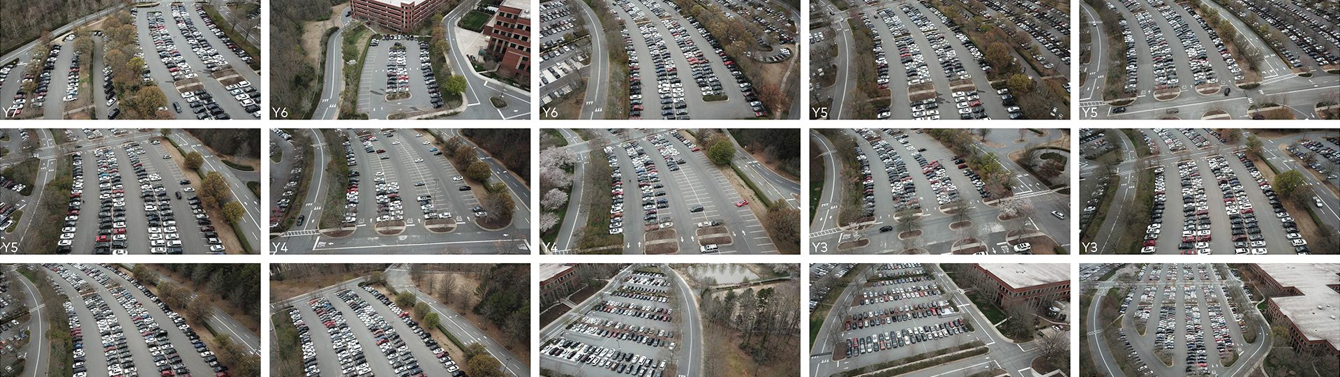
Mancini was tasked to undertake a parking study for a national financial client at a massive corporate center that is due for renovations. The 157-acre site is home to a 2.2-million-square-foot facility, and it comes with, you guessed it, acres of parking lots to be analyzed. A major issue for parking lots of this magnitude is that there is constantly ongoing movement and it’s difficult to get precise information. The best way to get accurate counts in this instance is a bird’s-eye view, now possible with drones. So, armed with the latest drone technology, our FAA-certified drone pilot traveled to the site and got started.

Typically, it takes a team of up to three people a half a day (four hours) to accurately count a site this size. And that’s for a single time stamp. Once our pilot had a plan, and input coordinates to the drone-piloting software, the drone was placed on an auto-pilot circuit that could do a time stamp of the entire site in five minutes.
The Mancini drone went up twice an hour for two days straight, accurately creating individual time stamps. So now, instead of only four time stamps in two days’ worth of counting, we had 36! We were able to accurately see what spots were filled up at specific time intervals which provided key utilization statistics for planning. This data helped us understand and inform the plans for building renovation and phasing, including where future expansion could possibly happen using the space available.
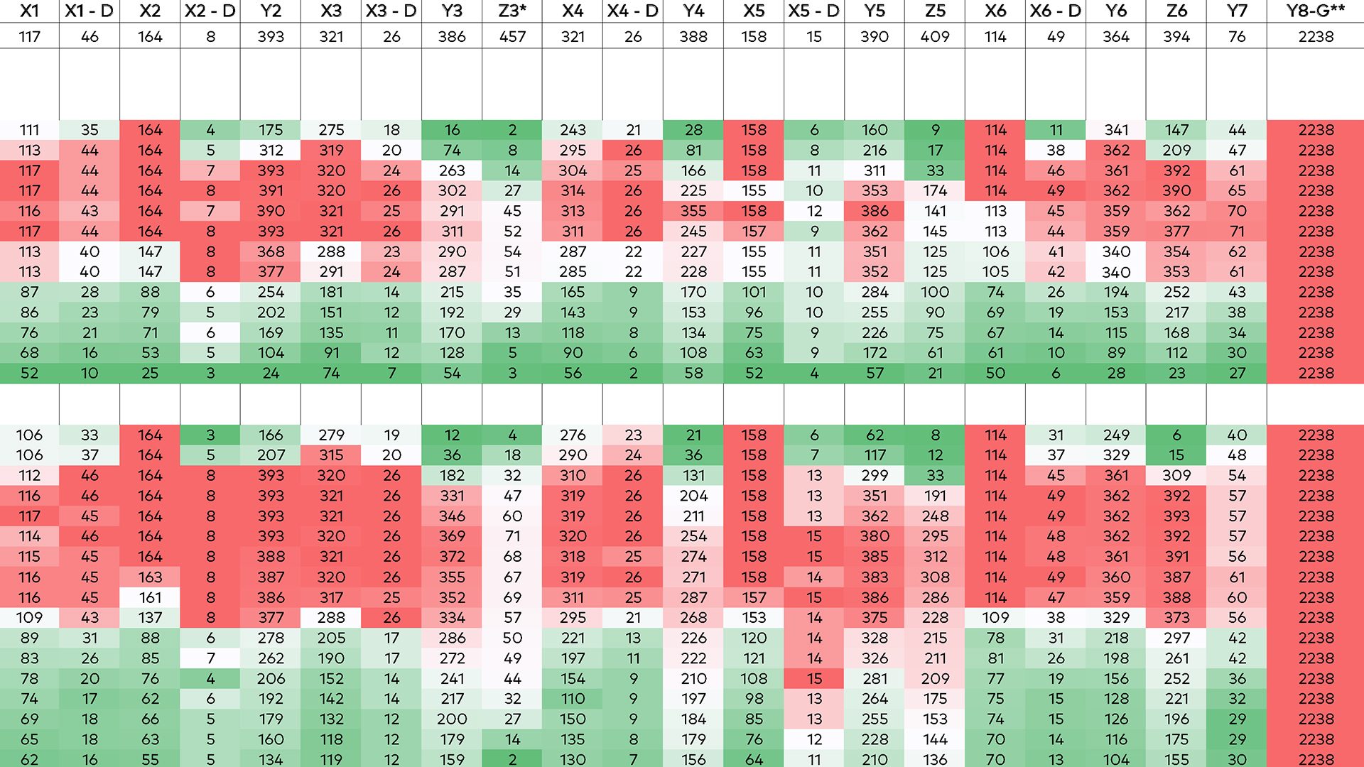
Using drone technology our pilot was able to collect 36 time stamps in 180 minutes over two days. To get this amount of data it would have taken a three-person team 432 hours (or 25,920 minutes) over 18 days. That is a 14,400% increase in time utilization and a 16-day decrease in schedule. Simply put, the data we were able to collect with the drone would have been impossible by person. Viewing the heat map with hour-by-hour data helped streamline client decision-making by providing facts for the design team to analyze and produce solutions for.
Drone technology is helping Mancini with projects like campus-wide master planning, zoning analyses, interior mapping and even helping us get great images of our work. With drones, we can cover all aspects of a large planning project and can accurately obtain valuable data on traffic, parking, circulation, efficiencies, sustainability and other metrics.